

Mappls MapmyIndia Maps
Mappls MapmyIndia Maps serves as a comprehensive digital mapping and location intelligence platform tailored to fulfill the navigation, mapping, and geospatial requirements of users throughout India and beyond. Drawing on decades of local mapping expertise, it provides highly accurate maps, extensive place information, and sophisticated navigation features that serve individuals, businesses, and government entities. In contrast to many international mapping services, Mappls MapmyIndia Maps is created with a strong emphasis on local data accuracy, making it particularly trustworthy for Indian roads, addresses, and points of interest.
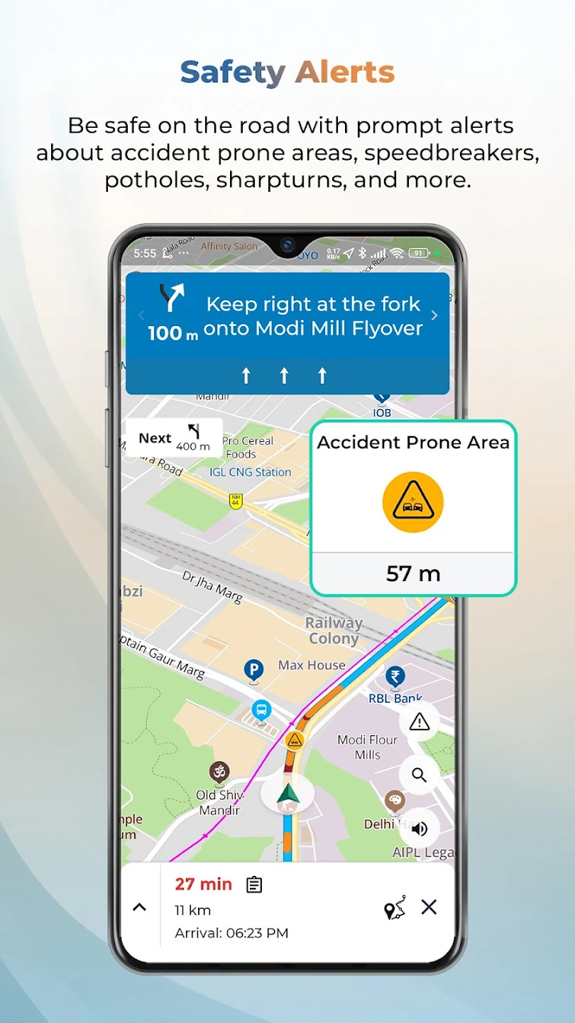
A significant advantage of Mappls MapmyIndia Maps is its accurate navigation system. The platform offers turn-by-turn voice navigation along with real-time traffic updates, lane guidance, speed alerts, and rerouting capabilities. These features assist users in saving time, minimizing fuel usage, and steering clear of congested routes. The navigation experience is tailored to Indian driving conditions, which include narrow streets, intricate junctions, and frequently changing road configurations. Whether navigating within a city or traveling between states, users gain from precise directions and reliable route recommendations.
The maps feature an extensive database of points of interest, including restaurants, hospitals, petrol stations, ATMs, tourist sites, government offices, and local businesses. Each location is supplemented with valuable information such as contact details, operating hours, and user reviews when available. This facilitates users in discovering nearby services and planning their trips effectively. The search functionality is crafted to recognize local place names and variations, enhancing usability for users from diverse regions.
Related Posts
For businesses, Mappls MapmyIndia Maps offers robust location intelligence tools. Companies can seamlessly integrate maps and APIs into their websites, mobile applications, and enterprise systems to facilitate location-based services. Features like geocoding, reverse geocoding, route optimization, geofencing, and asset tracking assist organizations in enhancing logistics, delivery operations, fleet management, and customer engagement. Retailers can leverage spatial data insights to analyze footfall patterns, pinpoint optimal store locations, and target customers more effectively.
Government and infrastructure projects also gain substantial advantages from Mappls MapmyIndia Maps. The platform aids urban planning, smart city initiatives, disaster management, and public service delivery by supplying precise geospatial data and analytical tools. Since the maps are developed locally and adhere to national guidelines, they are particularly suitable for sensitive and large-scale applications where data sovereignty and reliability are crucial.
Privacy and data security are vital components of the platform. Mappls MapmyIndia Maps prioritizes responsible data usage and provides users with control over location sharing and personal information. Regular updates ensure that maps stay current, reflecting new roads, changes in traffic patterns, and newly added locations. User feedback mechanisms enable individuals to report errors or suggest updates, fostering continuous improvement.
In summary, Mappls MapmyIndia Maps distinguishes itself as a powerful, India-centric mapping and navigation solution that merges accuracy, innovation, and versatility. Its extensive array of features caters to everyday navigation needs while also facilitating advanced location-based applications for businesses and institutions. By integrating local knowledge with cutting-edge technology, it delivers a reliable mapping experience that evolves alongside changing user requirements and geographic landscapes.


")

")

")
")


 Scheme Online")


")


")

 Scheme Online")

